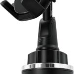
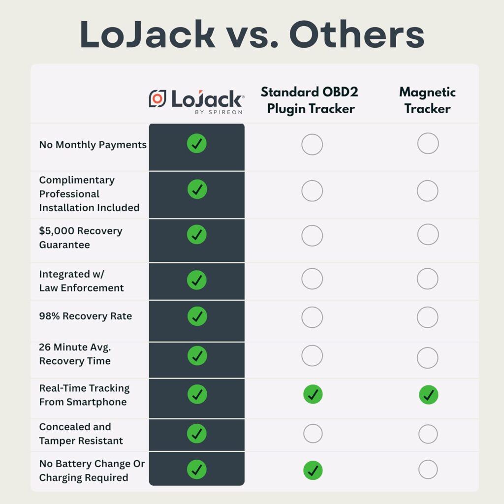
Car Phone Mount,Cup Holder Phone Holder,360°Adjustable Cup Phone Holders for Your Car,Anti-Shake Car Mount,Cradle Friendly Compatible with iPhone Samsung Google and All 4.0-7.0 inches Smartphones
Original price was: $29.99.$27.99Current price is: $27.99.
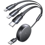
LISEN Multi Charging Cable, 3 in 1 Retractable Charging Cable, Retractable Car Charger with Type C/L/Micro USB Ports for iPhone 17 16 15 14 Pro/Samsung Galaxy S25/Kindle, Car Accessories for Women
Original price was: $14.98.$9.99Current price is: $9.99.
-19%


Richard McCain –
A good GPS
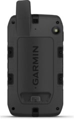
I’ve been known to go on long hikes and even backpacking by myself. My son has inherited that tendency, so several years ago I bought him a Garmin Montana. It heelps him find his way, and the inReach cpability lets his send messages to let people know he’s OK. I had a smaller Garmin I’ve used for years, and a Spot that I carried for communication and emergencies. After looking at that nice big screen, I decided to make the switch. Yeah, it’s a lot bigger than my old Garmin eTrex, but it also lets me communicate, and it gives me a good topo display. I’ve got the 24K-series chip with topos for Wa, Or, Ca & Hi. Works great: I live in Wa and my son lives in Ca. We usually meet somewhere in that region for backpacking trips, and most of my solo trips are in Wa or Or. I still carry a compass and a paper map, but it’s great to be able to see the topography on the screen. I’m a little concerned about battery life. So far, it’s worked pretty well on 2-3 day trips, but for a longer trips, I’d make sure to take a power bank to keep it charged. On a recent trip on the south side of the Wallowa Mtns, we also used it to find a route for the car. It sent us down a logging trail that was barely passable. Even a 4WD with good ground clearance would have had problems. In the future, I think I’ll turn off the 24K maps when I’m driving.
George Harrison –
Updated review: software fixed
Purchased in October and I use a Mac and the Connect software for updates. Trying to update with a Mac is impossible. It stops religiously at 50% of the downloads and then shuts down. This has been going on all along and after speaking with Garmin, I sent the unit back for a replacement. The new unit arrived and the Connect software STILL would not update my unit.Garmin has been aware of this issue since October and still has NOT found a solution. I recently was told that others have the same issue yet they still have not resolved this issue. What good is purchasing an expensive device and not being able to get the updates that you are entitled to?Extremely frustrated with this and am still waiting for a solution. Big company and they cannot or will not figure this out.
Jim Craig –
The best so far.
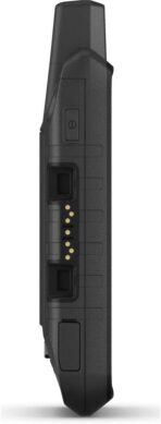
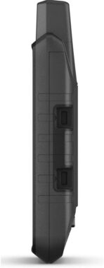
Of course everything in life is a compromise. This is heavier than its predecessors, and it isn’t cheap.It’s ideal for an ATV, motorcycle, hunting, etc. it has all of the outdoor capabilities built right into it, like dog tracking, heart monitor, cadence for bicycles, etc.The interface is certainly the easiest of the inReach thus far. Another big plus is the fact that it has a swappable battery.It’s certainly heavier then the previous versions of inReach, but of course it’s larger so that only makes sense.I’m sure not long down the road these things will become thinner, faster, etc., but as I said, right now this is the big cheese. The only thing that is missing is voice recognition.The only negative I have is the camera is almost worthless. I think we’ve become spoiled with the quality of photos on our smart phones, but the resolution on this is pretty bad. For me that’s not a big deal, because I don’t know that I would’ve ever used it anyway.
Bob Friesenhahn –
A clumsy heavy GPS that you may desperately need
I bought the Montana 700i almost a year ago. My purpose was to have high quality maps loaded which do not depend on cell data access, given that sometimes I might be 80 miles from a place where I could make a phone call, much less get data. Given that I am sometimes very remote, I wanted the InReach technology so I could call for help, and keep in touch with my family. I use the 700i when driving (in conjunction with a Garmin Nuvi, which works better for that) and also for daily walks and hiking. This GPS can be used as a driving GPS (with voice) just like Garmin’s driving GPSs if one purchases the associated suction cup mount (with integrated AMPS plate) but the routing calculations are slow, the screen is a bit small, and major intersection signs are not show as the dedicated driving GPSs do.Unfortunately, the Montana started having issues with going black, locking up, or needing to be restarted. At first I though that it was something I was doing (battery, cable, charger, etc), but the problem kept getting worse. So two weeks before the 1 year warranty expired, I requested a replacement unit and so now I have a new one.Important things to know about the 700i is that it is heavy, and the maps require downloading huge files (e.g. 5GB for one map) which can take quite a long time unless your Internet connection is very fast. The downloads seem to time out (especially on the popular maps) so it is necessary to restart them manually and nurse them along until they are done. For me it took over a day to download all of the maps for the GPS. The Garmin Express app used to update the maps has always been poorly implemented and it lies about what it is doing and what has gone wrong.I would complain about Garmin’s support, but my recent support experiences have been very good as if they totally revamped their support department, whereas they were very poor a year ago.
Chriz –
Tres bon produit , replacé 1 an apres en garantie pour un petit défaut mais tres bonne qualité !!! Des pros je recommande
Amazon Customer –
It not have uk maps, difficult to get all my money back
Franco –
tuuto ok
RMCP –
Decent, big unit works well in my ATV and Side by Side.
tonion –
Die Bedienung, wenn man es ein paar Mal probiert hat, ist einfach. Das Display ist so groß, dass man wirklich etwas erkennen kann und der Akku hält ausreichend lang. Ich habe schon mehrere Geräte gehabt (ich bin auch schon viele Jahrzehnte auf Tour), aber das ist das Beste!